
Fil:Map of Malta 2.png
Storlek på förhandsvisningen: 531 × 599 pixlar. Andra upplösningar: 213 × 240 pixlar | 425 × 480 pixlar | 987 × 1 114 pixlar.
Originalfil (987 × 1 114 pixlar, filstorlek: 1,34 Mbyte, MIME-typ: image/png)

|
This map has been uploaded by Electionworld from en.wikipedia.org to enable the |
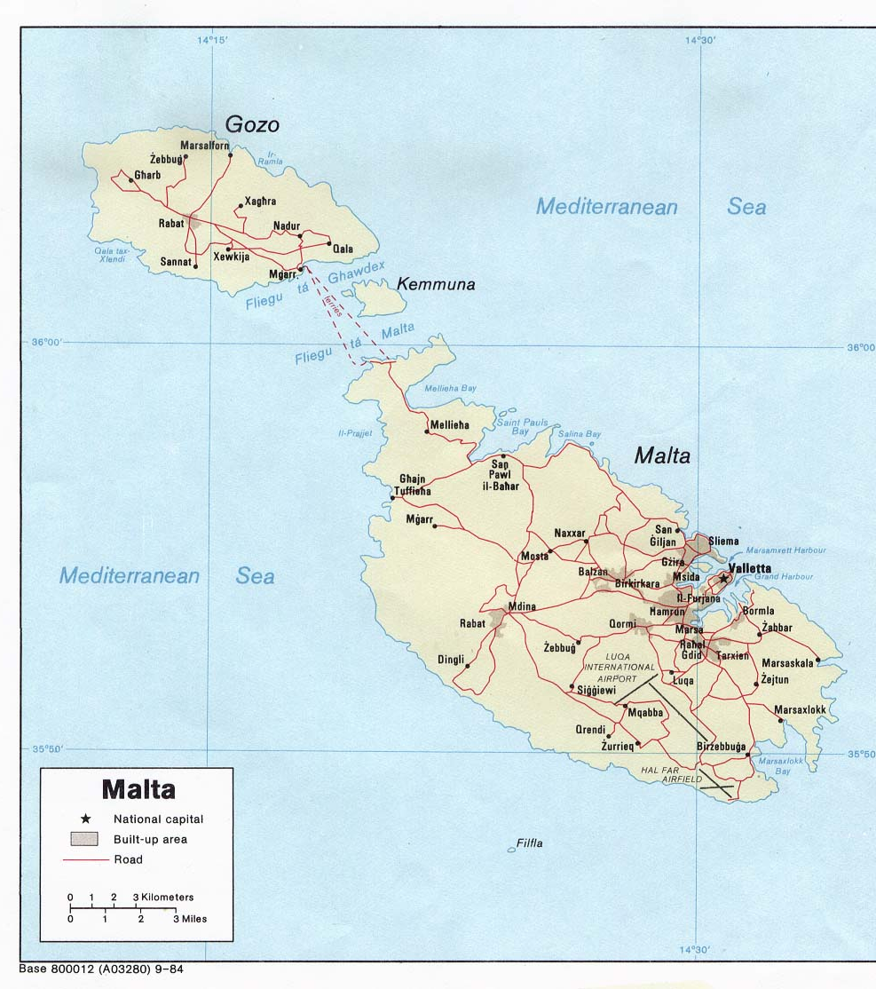
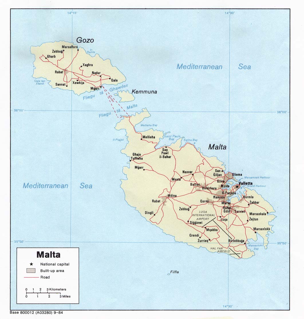
Political map of Malta. Created in 1984 by the Central Intelligence Agency.
This image is in the public domain because it contains materials that originally came from the United States Central Intelligence Agency's World Factbook.
|
 |
http://www.lib.utexas.edu/maps/europe.html
http://www.lib.utexas.edu/maps/europe/malta_pol84.jpg
Filhistorik
Klicka på ett datum/klockslag för att se filen som den såg ut då.
| Datum/Tid | Miniatyrbild | Dimensioner | Användare | Kommentar | |
|---|---|---|---|---|---|
| nuvarande | 27 december 2006 kl. 20.40 | | 987 × 1 114 (1,34 Mbyte) | Electionworld | {{ew|en|Neutrality}} Political map of Malta. Created in 1984 by the Central Intelligence Agency. {{PD-USGov-CIA-WF}} http://www.lib.utexas.edu/maps/europe.html http://www.lib.utexas.edu/maps/europe/malta_pol84.jpg |
Filanvändning
Följande sidor länkar till den här bilden:
Global filanvändning
Följande andra wikier använder denna fil:
- Användande på af.wikipedia.org
- Användande på bs.wikipedia.org
- Användande på ca.wikipedia.org
- Användande på de.wikipedia.org
- Användande på el.wikipedia.org
- Användande på en.wikipedia.org
- Användande på fa.wikipedia.org
- Användande på fr.wikipedia.org
- Användande på hr.wikipedia.org
- Användande på hr.wiktionary.org
- Användande på hu.wikipedia.org
- Användande på io.wikipedia.org
- Användande på ja.wikipedia.org
- Användande på mk.wikipedia.org
- Användande på nn.wikipedia.org
- Användande på pl.wiktionary.org
- Användande på ps.wikipedia.org
- Användande på ro.wikipedia.org
- Användande på sco.wikipedia.org
- Användande på sh.wikipedia.org
- Användande på sl.wikipedia.org
- Användande på sr.wikipedia.org
- Användande på te.wikipedia.org
- Användande på trv.wikipedia.org
- Användande på tr.wikipedia.org
- Användande på uk.wikipedia.org
- Användande på zh.wikipedia.org